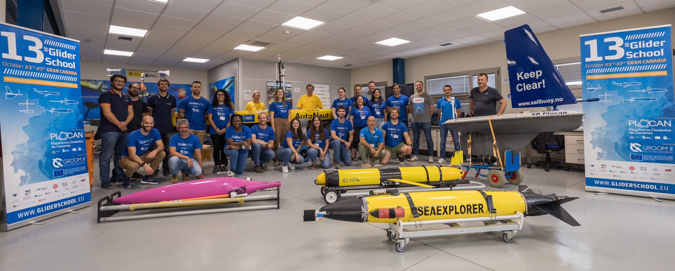
The autonomous vehicles of the Oceanic Platform of the Canary Islands (PLOCAN) sailed nearly 18,000 nautical miles in 2020 in nine scientific and observation missions, which involved 255 days of operations and the simultaneous control of four vehicles at sea.
In 2020 the glider activity in PLOCAN’S Integrated Observatory and its surrounding areas included several scientific-technical missions of diverse nature and scope, belonging to initiatives, programs and projects of an international nature, of special relevance and uniqueness.
The activity was coordinated and developed by the Area of Underwater Vehicles, Instruments and Machines of PLOCAN, participating in nine missions in which five different technologies of surface and underwater glider were used: Seaglider, Slocum, SeaExplorer, WaveGlider and Saildrone.
Among the events of 2020, at the beginning of December, during the third seasonal mission of the year in the waters of the Canary Islands, a Slocum G2 submarine glider detected a Mediterranean water eddy (Meddie) of an approximate dimension of the island of Gran Canaria near the western coasts of the islands of Lanzarote and Fuerteventura. It is an unusual find in the Canary Islands, specifically between the eastern islands of the archipelago.

Among the missions developed in 2020, three transnational accesses (TNA) stand out in the framework of the European project EU-Marine Robots (EUMR), which proposes an access-infrastructure for the deployment of a full-range of aerial, surface and sub-surface marine robotic assets, the combined value of which is far greater than the sum of their parts. The main objective of the EUMR project is to open up key national and regional marine robotics research infrastructures (RIs) to all European researchers, from both academia and industry, ensuring their optimal use and joint development to establish a world-class marine robotics integrated infrastructure.
A Wave Glider SV2 surface vehicle completed the two-month iFADO-AZORES mission between the Azores and the Canary Islands within the framework of the iFADO project, funded by the European Interreg Atlantic Area program, which aim is to create marine services on a regional and sub-regional scale, using European Union waters as a case study. Filling the existing technical gaps, iFADO will use the implementation of the Framework Directive on Marine Strategy (FDMS) to demonstrate the application of innovative products.
Within the framework of the characterization of the North Atlantic Ocean and the Macaronesia region, the three-month Lisboa2020_1 mission was carried out with a Seaglider submarine vehicle between the Nazaré Canyon (Portugal) and Gran Canaria corresponding to the bilateral ocean observation program which is maintained by the Hydrographic Institute of Portugal and PLOCAN.

This glider sailed towards the Gorringe Bank, located 125-180 miles southwest of Cape St. Vincent through a region of little explored seamounts, such as Gettysburg, Ampere, Unicorn and Seine, followed to Madeira, the Wild Islands, and to the island of Gran Canaria, where the mission ended.
The longest mission, ATL2MED, was led by the company North American Saildrone and the European Infrastructure (RI) ICOS, and it lasted nine months. It has been a milestone in autonomous maritime navigation, using two ASV-Saildrone vehicles, and it has allowed continuous observation of the waters of the eastern Central Atlantic Ocean and the Western Mediterranean Sea. It began in Gran Canaria in October 2019, passing through Cape Verde, Canary Islands (ESTOC Observatory), Gulf of Cadiz, Strait of Gibraltar, Alboran Sea, Balearic Islands, Gulf of Marseille, Ligurian Sea, Tyrrhenian Sea, Ionian Sea and Adriatic Sea, and ended in the Gulf of Trieste in July 2020, completing 274 days of navigation and 15,000 nautical miles.
“From the Atlantic to the Mediterranean” tested the Saildrone technology as a new autonomous vehicle approach for ocean observation, and compared the quality of the measurements of the different oceanographic and meteorological parameters carried out, with special interest in CO2, with those carried out by observatories fixed along the route, some of which have more than two decades of time series measures.

In 2020, the activities of PLOCAN’s autonomous vehicles addressed collaborative synergies of various kinds and scope with six companies and twenty-nine public institutions linked to marine-maritime sciences, technologies and services at both national, European and international levels, which once again highlights the strategic role that Singular Scientific-Technical Infrastructures (ICTS) play in technological development and provision of operational services through their highly specialized capabilities.
PLOCAN, as gliderport infrastructure, is a member of reference of European initiatives and working groups such as EGO, EuroGOOS, OceanGliders, OceanSites, EMSO, etc., and contributes with this type of activity both to the implementation of international operating protocols and standards and provision of services with autonomous ocean monitoring platforms, as well as the management and dissemination of the data generated.
Furthermore, an example of this is the contribution to the European strategy for the management and standardization of oceanographic data through direct cooperation with the Coriolis and EMODNet initiatives, which makes it possible to have real-time data collected by the glider in each of the dives, with quality control and standardized format.
Currently, and for the next three years, PLOCAN coordinates the European Glider Task Team within the framework of the EuroGOOS initiative.


